Chuysky Trakt: The Most Beautiful Road Of Siberia
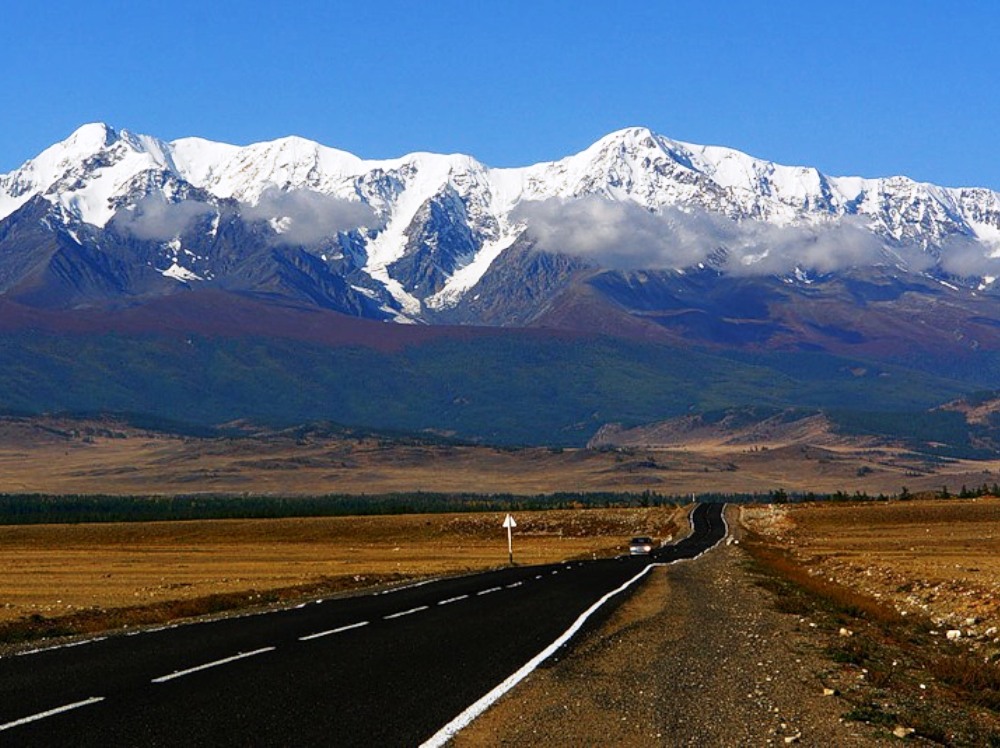
Chuysky Trakt is Over 621 mile long and it is included in the National Geographic’s top 10 most wonderful road trips in the world list. Taking this outstanding journey leaves even “I’ve seen it all” kind of traveler amazed. From small villages to mountains and hills filled with vegetation, everything catches the attention of those, who enjoy spending time on the road.
The Russian Altay Mountains are well known for their beauty. The Chuysky Trakt crosses them, all the way from one end of the country to the other. In fact, the road, which requires at least 4 days of driving to be crossed, is the main connection between Russia and Mongolia. Furthermore, this is among the few large roads worldwide that have an impressive history behind.
It is said that in 3,000 B.C. the southern Siberian travelers would travel all the way to Asia. They were crossing the Altay Mountains to reach Asia and returned home with goods, creating what is today the northern branch of the road.
The Tatar-Mongolian armies led by the legendary Chingishan, crossed the road to reach out to other countries and conquer new land.
The traces left by old civilizations and armies, including camp sites and ancient carvings, can be visited along the way. Also, the Aktru glacier, is visible right from the road. As travelers go further on their trip, the shops and hotels become fewer and more distant from each other.
Gradually, as the altitude grows, so does the beauty of the surrounding natural spots. Visitors can relax at the sound of springs and rivers flowing between the mountain rocks, while enjoying the view of the clear skies, vegetation and a seemingly endless road.


A Dmitriy/Flickr


Heli-skiing is among the list of extreme sports where skiers are ferried by helicopter to mountain peaks. It is a recent variation of skiing that had recently caught on. Check out article on how heli-skiing became popular.
UnusualPlaces Field Notes
- Location
- Zero Kilometer of the Chuysky Trakt memorial, Komunarsky Lane, Biysk, Altai Krai, Russia (route-start reference)
- Coordinates
- 52.5391491, 85.2227967
- Access
- The Chuysky Trakt is the 616.7 km section of federal highway R-256 from Biysk to Tashanta (checkpoint). The official Altai tourist center recommends starting at the Zero Kilometer memorial beside the Chuysky Trakt Museum in Biysk, then following signs for R-256. The map pin marks only that route-start memorial, not the road corridor. The road is paved according to a current local guide, but fuel and mobile reception become less reliable south of Aktash; download offline maps and check current road notices before departure.
- Admission
- The highway is not a ticketed attraction. The official Altai travel portal says there are no toll sections on the R-256 drive from Novosibirsk through Biysk to Gorno-Altaysk. This does not include paid attractions, bridges or side trips along the route; check each stop separately.
- Time needed
- No fixed drive-time estimate for the full Biysk–Tashanta section was found. The official Altai tourism portal presents a five-day, 1,050 km regional driving plan with the Chuysky Trakt on its first day; that plan includes other sightseeing stops and is not a driving-time estimate for this highway alone.
- Best season
- A current local Altai road guide says the highway operates year-round and recommends June or September for a scenic trip. This is that guide's recommendation, not an official guarantee; mountain weather can still affect travel.
- Opening hours
- There are no attraction-style opening hours for this public highway; it is listed as operating year-round. Temporary weather restrictions can affect particular vehicle classes: the Altai Krai Transport Ministry reported a five-hour March 2026 restriction on buses and heavy trucks while passenger cars remained open. Check the current road status before setting out.
- Location checked
- 2026-10-02
- Facts checked
- 2026-10-07
Location
Use the zoom buttons or pinch to zoom. Use arrow keys to pan when the map is focused.
Interactive map loads when in view.
Explorer Passport
Next badge: Trail Scout
Unlocked after exploring 5 different unusual places.
0 of 5 places explored

Discover more from Unusual Places
Subscribe to get the latest posts sent to your email.


Just curious why it takes 4 days to cross this 621 mile stretch. Most of the photos show well paved roads. It is due to the weather? If this road was in the USA, I’d guess it would be an 8-12 hour drive, depending on weather conditions.